Email Us

Core Technology

DUAL-RTK

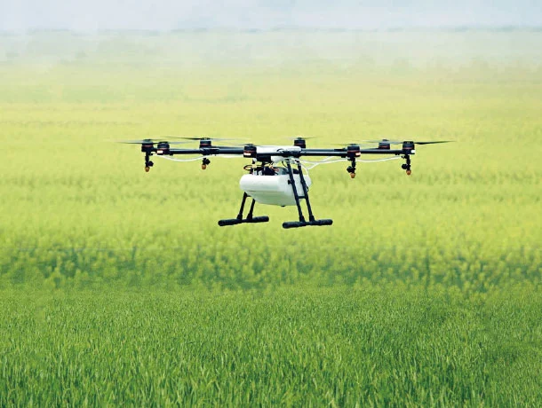
Dual-RTK Solution realizes the dual-RTK of single-board dual-antenna positioning and heading receiver (UM982). It makes full use of the signals of the master antenna and the slave antenna in GNSS receiver, starts the dual-RTK algorithm, and realizes the output of dual-RTK positioning result. The two RTK can check each other to improve the positioning reliability. After Dual-RTK Solution is enabled, the GNSS receiver will output two high-precision RTK positioning results, clearly marked as the RTK positioning results of the master or slave antenna. This technology will enhance the reliability and improve the availability of GNSS receiver especially in the actual road and farm work. When the main antenna signal is blocked, the main antenna cannot yield high-precision RTK positioning result, but the slave antenna can still do the RTK positioning solution, providing reliable high-precision position information for UAV, automatic farm machinery of precision agriculture, and outdoor robots etc.

DUAL-RTK
INSTANT HEADING

INSTANT HEADING utilizes the synchronized, symmetric, and multi-path mitigated all-system and full-frequency observation data provided by the two antennas, and introduces multi algorithms to realize single-epoch fixed ambiguity, greatly enhancing the heading timeliness and reliability. Thanks to the optimized heading algorithm matrix operations and the floating-point calculation of hard acceleration of Unicore SoC, even in situations where more than 50 multi-frequency satellites are involved in heading solution, a more than 50 Hz heading update frequency is still available, perfectly meeting the requirements of high dynamic, high precision, high usability and high reliability requirements.

INSTANT HEADING
RTKKEEP

RTKKEEP can eliminate the errors due to satellite orbit, clock difference, ionosphere and troposphere that affect the positioning accuracy through model and parameter estimation after the data interruption of base station. Even after the correction data is lost, the centimeter-level positioning accuracy can be maintained for more than 10 minutes. This can greatly improve the usability of RTK, especially for UAV, forestry and other applications where radio or wireless network communication is often interfered or blocked.

RTKKEEP
TDIF

TDIF makes full use of the carrier phase, pseudo-range and the Doppler. Integrated with original positioning solution algorithm, the ambiguity of whole cycles of carrier phase and clock error of receiver can be eliminated well to get better accuracy. Compared with the traditional pseudo-range and Doppler positioning result, the results of the TDIF are smoother, with less dithering and higher accuracy. TDIF provides a smooth positioning solution without the differential data of the base station. Its relative positioning accuracy is kept within 1cm between two consecutive epochs. Within 15min or even 30min, the relative positioning accuracy will be within 10cm. TDIF is mainly used to provide better solutions for precision agriculture and mechanical control (such as seeder, harvester, grader). TDIF’s excellent relative positioning accuracy can fully meet the requirements of automatic operation of agricultural machinery.

TDIF
UGypsophila RTK

UGypsophila RTK technology is based on the advantage of multi-system and multi-frequency tracking ability, the perfect cycle slip detecting and repairing technology, and ultra-wide lane ambiguity combination algorithms. The UGypsophila RTK can involve the satellites which doesn’t exist in the corrections from the base station into the RTK solution even if the base station used by the customer does not have the full-system full-frequency function. It can make the most use of the observation data of all frequencies from all systems in the rover side and greatly improving the usability, reliability and accuracy of RTK. The UGypsophila RTK technology can solve the problem that many satellites received by rovers cannot participate in RTK solution which caused by the defects of base station and give full play to the all-system full-frequency advantages.

UGypsophila RTK
STANDALONE

STANDALONE technology will fully use the navigation information from the receiver, and according to the models algorithm and parameter estimation algorithm to eliminate errors form satellite orbit, clock errors, ionosphere and troposphere to get better positioning accuracy by itself and does not need the correction data and precise ephemeris. Standalone mode can help the receiver achieve centimeter-level accuracy which is corresponding to the first navigation point without any external support. It can greatly reduce cost and application complexity. According to the test result, with STANDALONE technology, it can maintain 5-20cm accuracy for 30 minutes, and 30cm accuracy for 1 hour. It can solve the path-by-path issues for many applications, such as agriculture machine, UAV and intelligent robot.

STANDALONE
NANOPPS

NANOPPS technology is based on the multi-system multi-frequency timing system of Unicore, including GPS L1/L2/L5, BDS2 B1/B2/B3, BDS3 B1C/B2a/B1I/B3I, GLONASS L1/L2, Galileo E1/E5b/E5a, and QZSS L1/L2/L5. It can significantly lift the timing accuracy to 2 nanoseconds and the availability to 99.99999‰. The technology uses the pseudo-range and carrier phase observations to reduce the noise, uses multi-frequency observations to enhance the anti-interference ability, uses unique tropospheric model to eliminate the ionosphere and troposphere errors. It will solve the problem that the traditional satellite signal timing can be easily affected by signal interference and other factors which will leading to timing failure.

NANOPPS
ULIGHTNING

ULIGHTNING technology is a kind of high-performance full-sync time-wheel scheduling technology adopted by Unicore in integrated navigation products. In terms of integration method, the unique Ufusion algorithm can adapt to various external input information and adopt the optimal integrated filter algorithm. The GNSS and INS both adopt the same clock, with small time synchronization error and high information synchronization accuracy, and can flexibly control the calculation and output sequence of GNSS and INS information, so as to meet the output of 100Hz position, speed and attitude data, and minimize the output delay, making the output delay less than 3ms.

ULIGHTNING
UMDM

UMDM technology aims as different multipath interferences, adopts such methods as anti-multipath phase discriminator, frequency domain multipath detection and elimination, multipath signal switching detection, PVT screening of multipath interferences and weight adjustment. According to the test result, these methods can effectively suppress the influence of multipath interferences on the observation quantity and positioning accuracy. Therefore, in the environment of serious multipath interference, such as urban area and other places with shade, the UMDM technology will help to suppress the multipath interference and improve the positioning accuracy of GNSS.

UMDM
UFRIN

UFRIN technology uses original output of the already-existing inertial sensor to determine whether the vehicle’s motion and navigation’s filtered error converge without considering the installation angle. Once the GNSS has been lost, the algorithm estimates the car movement’s restrictions and creates virtual observation to suppress the accumulation of IMU’s error. This will help to ensure unrestricted installation and MEMS accuracy and keep the navigation stable, reliable and accurate. It includes data collection, vehicle’s movement verification, carriage phase convergence verification, installation angle / installation angle error calibration and vehicle’s integrated position. This kind of technology will help to reduce the dependency on the satellite information and improve navigation’s reliability in the complex landscape of modern urban areas.

UFRIN
GNSS Smart Engines

GSE is an intelligent power supply management algorithm and can be used with already released Unicore Communication’s chips and modules. By combining software calculations, power control unit, RF chip and CPU baseband, the technology can differentiate the user environment, actively choose appropriate power level and ensure required accuracy. It supports flexible power management system which is used to support external configuration hibernating chips that keep the consumption at as low as 30uA. At the same time, the intelligent software algorithms can verify the user environment, automatically control the components and keep the operational power consumption at the lowest possible level.

GNSS Smart Engines
CONTACT
Subscribe
Subscribe to get news updates from us